原文作者:readwriteweb
原文链接:Google Earth Now Maps the Ocean Floor and Mars in 3D -
译者:pestwave
Google刚刚发布了一个Google Earth更新包,其中包括传闻中的海底地图。 此外Google Earth还增加了三个新功能:浏览历史图片、记录旅行路线的“旅行”功能,以及3D火星地图。
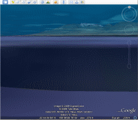
海底地图
有了海底地图,你就可以在3D模式下探索海底世界了,并且该地图提供了大量相关视频和静态图片。
历史地图
用户可以通过“历史地图”功能查看某个地理位置随着时间的变化。点击工具栏上的时钟图标,就会出现一个时间坐标,你可以根据时间坐标选择图片。
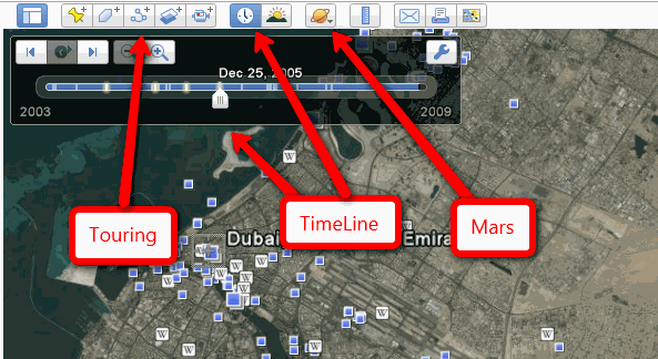
旅行
Google Earth另外一个新功能就是记录你的旅行路线。点击录制按钮,你在Google Earth上的所有行动路线都会被记录下来,之后可以回放,并和好友分享。
火星地图
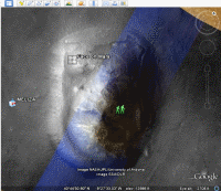
此外Google Earth还提供了火星的3D地图,并附有来自美国航空航天局的高分辨率照片。
视频介绍:
下载地址
添加评论
相关文章:
关于Google图书和解协议的支持、争议和评论
在新版 Google Earth 中潜水
深度网络搜索:Google下一场硬仗